


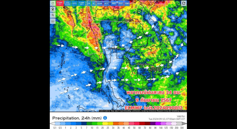


Yagi is still causing heavy to very heavy rain with strong winds in the northern and upper northeastern parts of Thailand., while the southwest monsoon is also quite strong over the upper Andaman Sea and the upper Gulf of Thailand, which is bringing heavy rain to parts of the eastern and western regions, said TMD Acting Director-General Thanasit Iam-anunchai in a notice issued today.
Residents were warned to be cautious of heavy rain and the risk of flash floods, especially in areas near mountain slopes, rivers, and low-lying areas.
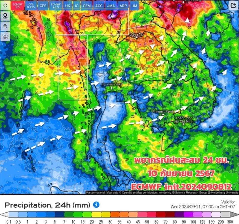
From Sept 10-18, the weather forecast indicates increased rainfall across Thailand due to the monsoon trough shifting southward and covering parts of the northeast. This will bring moderate rainfall to the northern, northeastern, central (including Bangkok), eastern, and southern regions, particularly along the Andaman coast, the TMD noted in a separate report this morning.
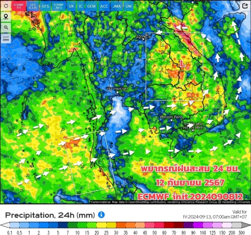
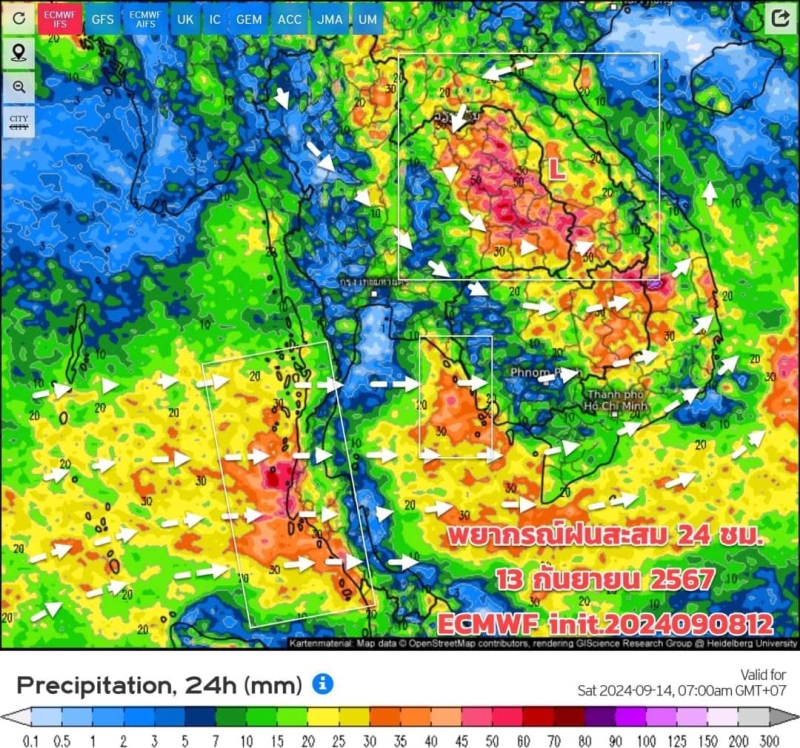
Heavy rain along the Andaman coast is forecast to intensify from Thursday (Sept 12), building to heavy to very heavy rain on Friday and Saturday (Sept 13-14).
Strong wind waves are expected in the upper Andaman Sea and the upper Gulf of Thailand, with wave heights of two to three metres, and over three metres in areas with thunderstorms. In the lower Andaman Sea and the lower Gulf of Thailand, waves will be one ot two metres high, reaching over two metres in areas with thunderstorms.
Sailors in the upper Andaman Sea and the upper Gulf of Thailand should avoid sailing in areas with thunderstorms. Small boats should stay ashore for the next day due to rough seas, the weather advisory said.
The Meteorological Department urges the public to stay updated on weather forecasts and be prepared for changing conditions, as heavy rainfall and storm systems could still affect the country in the coming days.
People were urged to stay informed of weather notices and to follow updates from the TMD as weather patterns evolve,