


“Phuket province will not be affected as much as the provinces on the Gulf of Thailand,” an officer at the Southern Meteorological Center (West Coast) office of the Thai Meteorological Department (TMD) told The Phuket News this morning (Jan 4).
“Please don’t panic. Phuket will have stronger wind and heavier rain than usual. That’s all,” the officer added.
“Phuket’s situation will not be serious. There is no need to stock up on food and supplies for three days, as people on the east coast of the peninsular have been advised. That advisory is in case there is severe flooding over there, not for Phuket province,” the officer, who asked not to be named, noted.
The officer forecast for the first real effects from the tropical storm system to hit Phuket by about 4pm today.
“Winds might gust up to 60km/h, so houses with roofs that are not that secure might be affected,” the officer said.
However, the officer did not downplay the seriousness of the precautions being taken to prevent injury or disaster in the region, especially the ban on all boats from leaving shore, as handed down by Prime Minister Prayut Chan-o-cha late yesterday. (See story here.)
“We understood that people are concerned about this. We have received calls from people asking the same questions about tropical storm Pabuk,” the officer explained.
Meanwhile, Phuket Governor Phakaphong Tavipatana has also ordered Phuket’s emergency services to be on standby and to make sure essential services are maintained. (See story here.)
That order was handed down after Phuket Marine Office Acting Chief Wiwat Chitchertwong issued a notice on Wednesday (Jan 2) banning all small boats from leaving shore during the heavy weather warning period, with waves forecast to reach up to three metres high through Saturday (Jan 5) and up to 70% of the island expected to be hit with heavy rain. (See story here.)
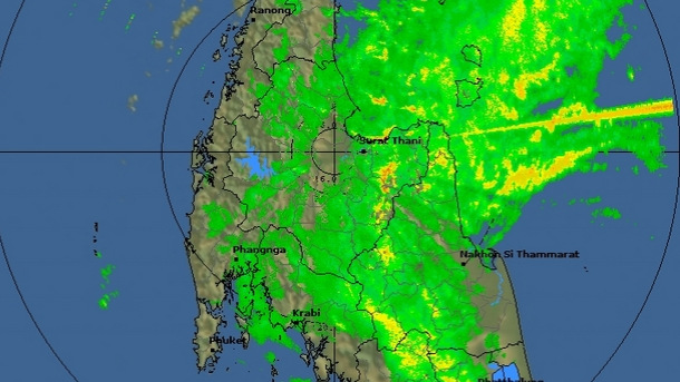
The TMD this morning issued an updated weather warning for the region, noting at 10:30am that Pabuk was now 125km southeast of Nakhon Sri Thammarat Province (Latitude 8.0 degrees north, longitude 100.9 degrees east).
“With maximum sustained winds of 75 km/hr, the storm was moving west-northwest at a speed of 25km/hr expectedly to make landfall by today (4 January) over Amphur Pak Phanang and Amphur Tha Sala Nakhon Sri thammarat.
“It will affect the South with widespread rainfalls, and torrential downpours are possible over much of the area. People should beware of the severe conditions that cause forest runoffs and flash floods,” the warning noted.
Affected areas were given as follows:
Jan 4: Torrential downpours and strong winds: Prachuap Khiri Khan, Chumphon, Surat Thani, Nakhon Sri Thammarart, Phatthalung, Songkhla, Pattani, Yala, Narathiwat, Ranong, Phang Nga, Phuket, Krabi, Trang and Satun.
Jan 5: Torrential downpours and strong wind: Phetchaburi, Prachuap Khiri Khan, Chumphon, Surat Thani, Nakhon Sri Thammarart, Phatthalung, Ranong, Phang Nga, Phuket, Krabi, Trang and Satun.
“The strong winds are forecast with waves up to 3-5 meters high in the Gulf and 2-3 meters high in the Andaman Sea. All ships keep ashore lasting 5 January 2019. People in the Gulf should be aware of inshore surges,” the warning noted.